Early Settlement and Development of Plainfield, Massachusetts
A Historical Context for the Study of the Our Old House Project
In researching the history of Plainfield’s early homes, it becomes necessary to first understand how the town itself was formed. The story of these houses is inseparable from the broader history of land grants, settlement patterns, and community development in western Massachusetts.
The Land Before Settlement
Prior to European settlement, the region that would become Plainfield was densely forested with beech, pine, and maple. Its hills and valleys supported abundant wildlife and natural resources. While there is no evidence of permanent Native settlements within the town’s present boundaries, it is likely that descendants of the Mohican people used the land seasonally for hunting and foraging.
The Hatfield Equivalent
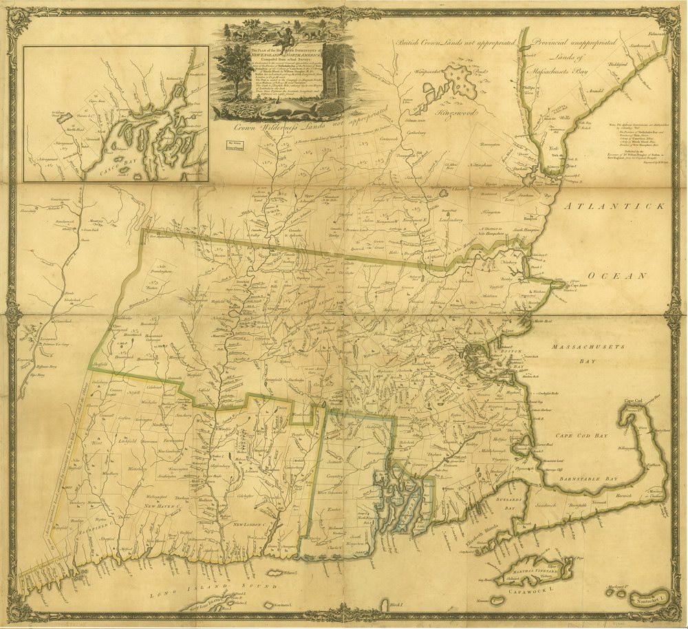
Plainfield’s origins lie in a larger tract of land known as the “Hatfield Equivalent.” This land was granted to the proprietors of Hatfield, Massachusetts, as compensation for acreage they had lost due to boundary errors. In the seventeenth century, imprecise surveying had led Massachusetts settlers to unknowingly occupy land that actually fell within Connecticut’s jurisdiction. After a corrected boundary survey in 1716, the Province of Massachusetts Bay redistributed lands to affected towns.
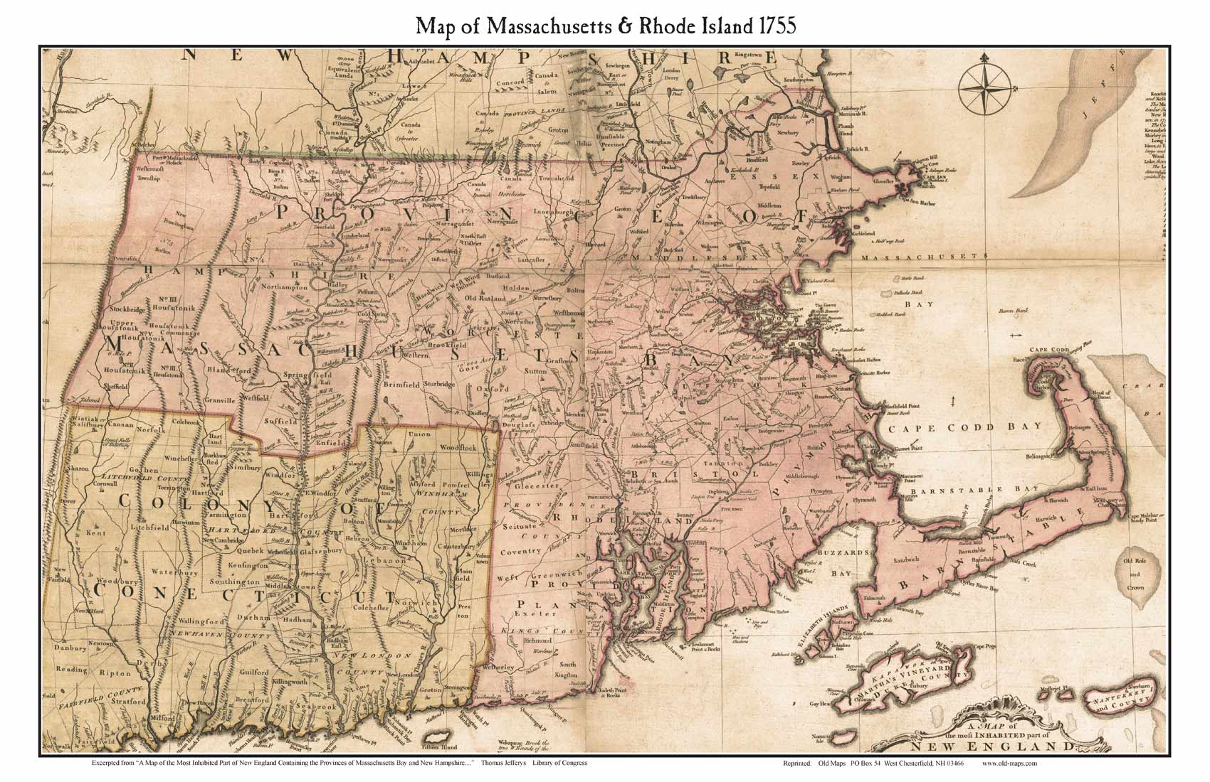
As part of this process, the Hatfield proprietors were awarded a large tract in western Massachusetts. This land—carefully surveyed and later found to exceed 8,000 acres—extended into what is now eastern Hawley. The proprietors then encouraged settlement by selling parcels to incoming settlers.
Plantation No. 5
At the same time, increasing population pressure in eastern Massachusetts led the colonial legislature to create ten new townships in the western part of the colony. Each township measured six miles square and was sold at auction in Boston.
On June 2, 1763, Plantation No. 5—encompassing what would later become the towns of Cummington and Plainfield—was auctioned at the Royal Exchange Tavern on King Street. Dr. John Cumings (1728–1788) purchased the tract for £1,800, paying £20 upfront and securing the remainder by bond. A list dated December 29, 1762, records twenty-seven additional proprietors who held shares in the township.
Overlapping Land Grants
Settlement of Plantation No. 5 was complicated by overlapping land claims. When surveyed, the township was found to include portions of three earlier grants:
- The Mayhew Grant (600 acres) in the northeast
- The Barnard Grant (600 acres) directly south of it
- The Hatfield Equivalent, a much larger and more precisely defined tract
Because of these overlapping claims, settlers often had to repurchase land from earlier proprietors, including members of the Barnard family. The Mayhew Grant later passed to the Wainwright family, who gradually sold off their holdings, with the final parcels conveyed in 1830.
Early Settlement
Despite these complications, settlement proceeded steadily. By 1765, at least seven homesteads had been established in what is now Plainfield. Many early settlers came from towns such as Abington, Bridgewater, and Weymouth, purchasing land either from the proprietors of Cummington or from Hatfield families.
These early farmsteads—often modest, timber-framed houses—formed the foundation of the town’s architectural and social landscape. Over time, all of the original tracts were divided and sold to individual owners, creating the pattern of dispersed rural homesteads that still characterizes Plainfield today.
Separation from Cummington
Initially, Plainfield was part of Cummington, but geography made governance difficult. The Westfield River presented a significant obstacle, and the location of the meetinghouse on “the Hill” in Cummington required Plainfield residents to travel down into the valley and back up again for church services and town meetings.
In 1785, residents of the northern section separated to form the District of Plainfield. However, as a district, Plainfield remained politically tied to Cummington and could not send its own representative to the General Court.
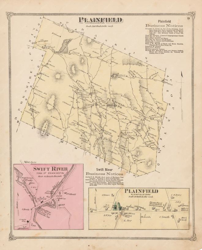
Shaping the Town
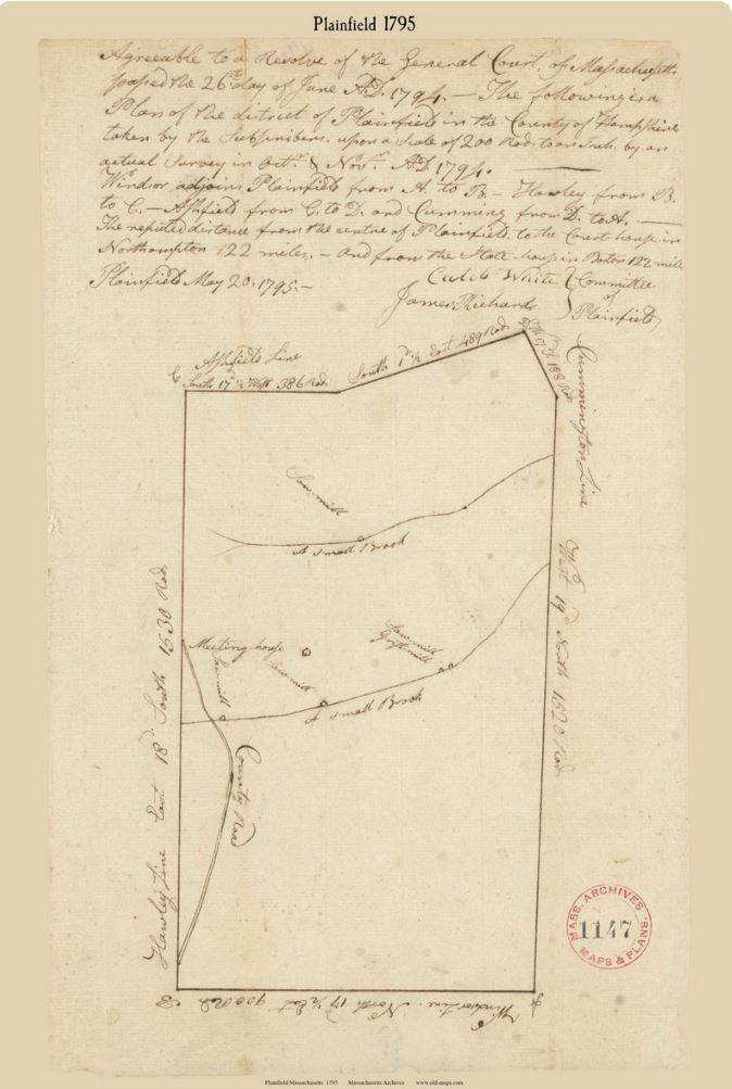
Plainfield’s boundaries were heavily influenced by the earlier land grants, resulting in the irregular borders still seen today. To ensure the district had sufficient land and population to become an independent town, the state later transferred a one-mile-wide strip from southern Hawley. This area included Hawley’s only natural ponds and a small village, representing a significant loss to that community.
Establishing a Town Center
In 1787, a committee was appointed to determine the geographic center of Plainfield and select a site for a meetinghouse. A location on high, level ground was chosen.
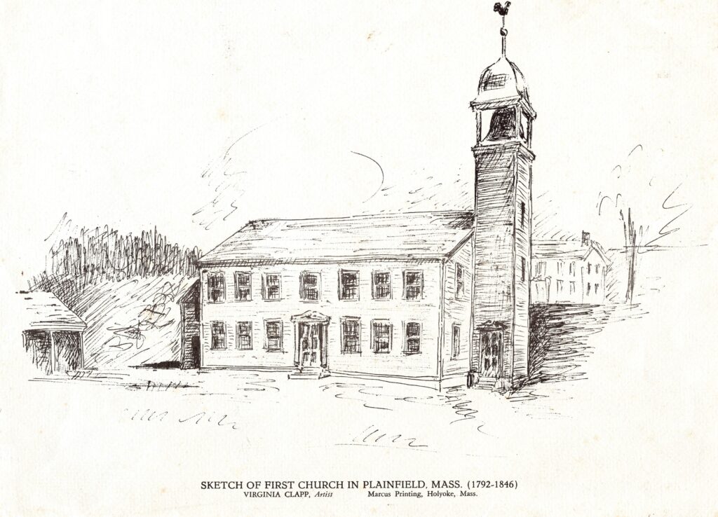
Land was set aside in 1791, and construction began in 1792. As was customary, community members contributed labor and materials, and pew owners even supplied rum for the building’s raising. Due to limited funds, the meetinghouse was not completed until 1797. The finished structure contained 44 pews on the main floor and 19 in the gallery, along with additional seating added later.
In 1792, the town also settled its first permanent minister, the Reverend Moses Hallock, a Yale-educated clergyman whose influence extended beyond Plainfield.
Incorporation and Governance
The question of land ownership—particularly regarding the Hatfield Equivalent—remained unresolved for many years. Finally, in 1803, a 4.8-square-mile portion was officially annexed to Plainfield, settling longstanding disputes.
With sufficient land, population, and organization, Plainfield was incorporated as an independent town in 1807.
Like other New England towns, Plainfield adopted a system of local governance centered on Town Meeting, with elected officials including selectmen, clerk, treasurer, and assessors. For the first sixty years, civic and religious affairs were closely intertwined, with the town overseeing both government functions and the support of the church.
Separation of Church and State
This arrangement changed following a constitutional amendment in Massachusetts in 1833, which formally separated church and state. In 1845, Plainfield voted to implement this separation more fully.
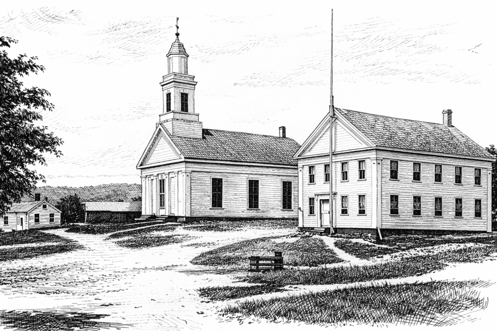
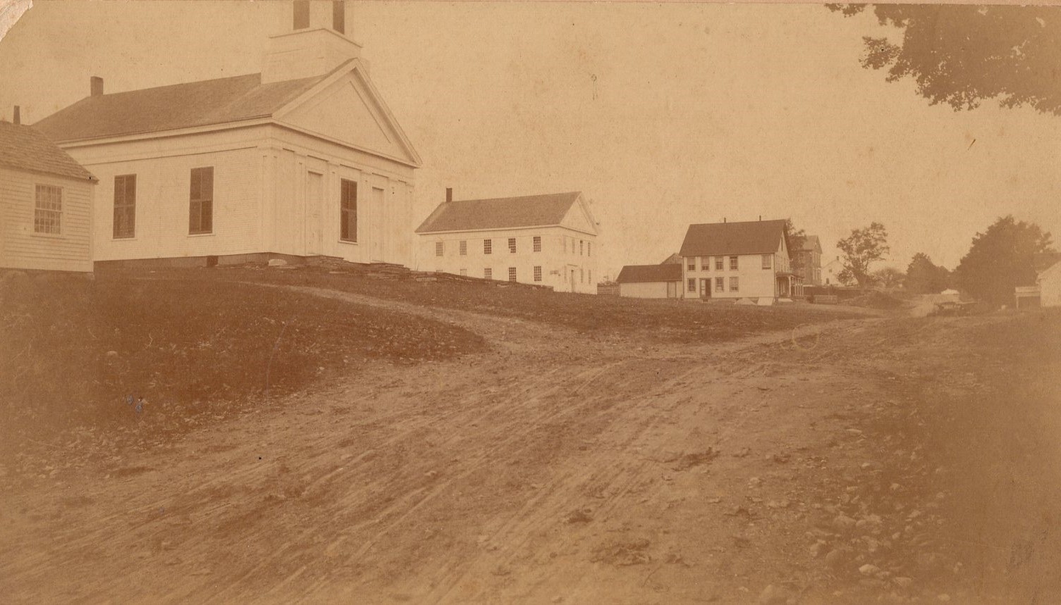
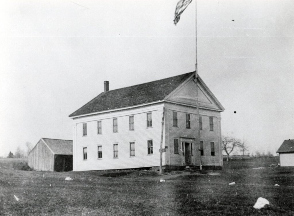
The original meetinghouse, which had served both civic and religious purposes for over fifty years, was dismantled. In its place, two new buildings were constructed: a church (completed in 1846) and a town hall (completed in 1847).
These two structures, aligned and facing south, remain a distinctive feature of Plainfield today—the only matched pair of public buildings of their kind in the surrounding hill towns.
Conclusion
The early history of Plainfield reveals a complex process of land distribution, settlement, and adaptation to geography. The town’s old houses—scattered across hillsides and along narrow roads—are direct products of this history. Built by settlers navigating overlapping land claims, difficult terrain, and an evolving community structure, they stand as enduring evidence of the town’s formation and growth.
This project has been partially funded by the Plainfield Historical Society and The Plainfield Cultural Council.