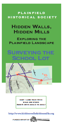
Surveying the School Lot
The land survey was, arguably, the most powerful weapon in the British quiver in conquering North America. Without the survey no land ownership, and without ownership as the carrot, there’s no sense in doing all that conquering. With compass, rod, and chain, colonists re-created a familiar world.
Plainfield is the result of five partially overlapping land grants, some surveyed with better results than others, made and sold between 1744 and 1763. With settlement in what is now Plainfield, Cummington, Hawley, and Ashfield in the late 1700s, it became clear that human relationships did not always follow the surveyors’ plans. A series of land swaps later, the current map of Plainfield emerged in the early 1800’s.
Learn about traditional “metes and bounds” surveys and some of the instruments that were used for it. Then get hands-on experience in how it was done by conducting your own survey of part of the “house” lot of the first minister of Plainfield, Moses Hallock, on whose land the Hallock Memorial School building stands.
Note: You will need a compass, a rope, and a stake for this activity, as described in the brochure.
★ Start at the star on the map and the stake in the ground at the SW corner of the lot (left bottom corner of the map) and, following instructions and the description on the deed of what is now known as the “School Lot,” measure it in Rods with your rope, stake, and compass, in the direction indicated. Following the directions, keep going around the lot, noting the stakes (if you can find them) at the corners. Continue all the way around, or until you are satisfied enough with your result that you might buy the lot on the strength of it.
P: Park in front of the Hallock Memorial School building (304/312 Main Street).
Printing the Map: Click on the brochure (R) to download (? MB). Use 8 1/2 x 14 (legal) size paper, portrait orientation; turn off automatic sizing, scaling, and text orientation (important*); fold in three with the map on the inside. You should be able to fold the text up and down to consult it and map in turn. [*Some newer printers want to flip the text on the text side. Make sure it remains upside down in relation to the map.]
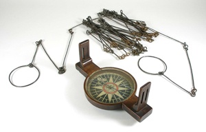
Chain and Compass
Dear Guest — a warning and a request:
Be careful: Wear sturdy shoes. Stone walls, cellar holes and their wells, and mill foundations are breathtaking andtreacherous works of art. Do not ever climb on, in, or over them. If you make a wall come down, you will have destroyed it forever and you will be hurt. Cellphone: not so much.
Protect yourself against TICKS. You know what to do. If not: CDC
Walk softly. Pack out what you pack in, but leave rocks, plans, and any older metal or glass you happen to come across for the next adventurer to find. Recent trash: please pack it out.
Respect private land. The tours take you on publicly accessible land but the lot next door may be private. In general, if it isn’t posted you may go, but you should ask if you want to you to walk across someone’s field. ~ Thank you and enjoy yourself!