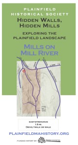
Mills on Mill River
Click here for Mills on Mill River map
In the 1830’s New England counted more than 5,000 water-powered mills and small factories, all of which were called “mills.” Plainfield, with its steep mountain streams, had at least a dozen, and they powered a mixed economy with small industry.
Take a walk along the Mill River, which sports the foundations of grist and saw mills, a tannery, and factories that produced a variety of items, including broom handles and woolen cloth. The last mill closed in 1924. Along the way, learn how mills work, how to “read” mill foundations, and find a former mill pond in the contours of the landscape.
★ Start at the Plainfield Historical Society Mill Site. The tour threads uphill and up stream on River Road to West Hill Road poking around some mill sites and merely viewing others, for 1.4 miles. If you plan to go off the road, wear boots.
After leaving the PHS site, the tour makes a small detour to the right on Union Street to view the Wilcutt Mill, which you may look under if you are careful, but which you may not enter, and find the route the water traveled from pond to wheel. It then returns to River Road, passing a tannery site and ending at the intersection of River Road and West Hill Road and the Streeter satinet factory which site on private land but can be seen very well from the road. PLEASE BE CAREFUL AROUND MILL FOUNDATIONS, preserving your own health and our heritage landscape.
P: From the Plainfield Town Hall cross Route 116 and take South Union Street for a mile, merge left onto River Road and park at the intersection of River Road and Lincoln St. There is room for 2 cars if you squeeze them in. There is also room for 2 cars at the intersection of West Hill and River Roads.
Printing Mills: Click on the brochure (R) to download (11 MB). Use 8 1/2 x 14 (legal) size paper, portrait orientation; turn off automatic sizing, scaling, and text orientation (important*); fold in three with the map on the inside. You should be able to fold the text up and down to consult it and map in turn. [*Some newer printers want to flip the text panels on the text side. Make sure they remain upside down in relation to the map.]

Dam and Water illustration by Gail Fusco
Dear Guest — a warning and a request:
Be careful: Wear sturdy shoes. Stone walls, cellar holes and their wells, and mill foundations are breathtaking and treacherous works of art. Do not ever climb on, in, or over them. If you make a wall come down, you will have destroyed it forever and you will be hurt. Cellphone: not so much.
Protect yourself against TICKS. You know what to do. If not: CDC
Walk softly. Pack out what you pack in, but leave rocks, plans, and any older metal or glass you happen to come across for the next adventurer to find. Recent trash: please pack it out.
Respect private land. The tours take you on publicly accessible land but the lot next door may be private. In general, if it isn’t posted you may go, but you should ask if you want to you to walk across someone’s field. ~ Thank you and enjoy yourself!